Your cart is empty
WORDS AND PHOTOS BY Ben Masters
Watch the trailer for the feature length film at the bottom of this page or visit The River and The Wall
ORIGINALLY PUBLISHED IN MODERN HUNTSMAN, VOLUME THREE: WILDLIFE MANAGEMENT
In Texas, mountain lion harvest is virtually unregulated. They can be hunted and trapped 24/7/365 without bag limits, seasons, or the 36-hour trap check requirements for other fur-bearing species such as foxes, beaver, or ring-tailed cats. It is common for Texas hunting and livestock operations to hire professional lion trappers to set out dozens of leg hold traps, bait them with a scented lure, and leave them for weeks to months. When caught, the lions die from exposure. Some die quickly, others take days. In the puma’s distribution range from Alaska to Argentina, there is no other state or country that has such loose regulations on mountain lion harvest and trapping as Texas. Yet they somehow continue to persist in the rugged mountains of the Trans-Pecos, the broken borderlands along the Rio Grande, and the South Texas brush country. How?
Over the past decade, biologists at the Borderlands Research Institute (BRI) in Alpine, TX have been catching mountain lions, attaching GPS collars, and studying their diet, distribution and mortality to help wildlife managers, landowners and agencies make data-driven decisions. And the data they’re uncovering is so damn fascinating! Some cats went on treks for hundreds of miles, others ate almost exclusively javelina, and one little badass 100-pound female was killing an elk five times her size with her teeth every month! As a former hunting guide and biologist turned wildlife filmmaker, the appeal of making a short film about the research was way too strong for me to resist. I approached the Borderlands Research Institute team, they agreed to let me tag along with a camera, and we set out to produce the short film Lions of West Texas about catching lions, strapping GPSs on them, and getting a fascinating glimpse into their mysterious lifestyles.
For four incredible months, I set out trail cameras across West Texas’ Davis Mountains, helped biologists set snares to safely capture the lions for studying purposes, and followed researchers through magnificent landscapes seeking GPS coordinates that indicated where the collared cats had made kills. Of the 24 cats that the biologists collared, and from over 200 kill sites investigated, the mountain lion diet consisted of 25% mule deer, 16% elk, 14% white-tailed deer, 12% javelina, 9% feral hog, 4% aoudad, 4% coyote, 2% scavenge and 14% miscellaneous mammals. Cattle were present in the study area but no livestock predation was documented. The average home range size was 150 square miles, the maximum home range size was 400 square miles, and multiple dispersal events were recorded, the longest being over 150 miles when a juvenile male went in search of a new territory but found a leg hold trap instead. He died from exposure in the trap. In fact, all of the observable deaths in the study except one of unknown cause were at the hands of man. One was killed by researchers in an accident, and the others all died from leg-hold traps. The annual survival rate was only 53% which begs the question… how in the world are there still mountain lions in Texas if nearly half of them are dying every year?
The numbers don’t add up, and there are three theories to explain their existence. The first theory, for which there is no supporting evidence, is that there are high-surviving and high-reproducing “pockets” of females that bolster the population. The second theory is that there isn’t sufficient data in the study to represent the population as a whole, and that population survival is greater than the sample size data indicates. The third theory is that the West Texas population of mountain lions is dependent on dispersals and recruitment from Mexico and New Mexico. Personally, I’m a believer in the third theory, but I don’t have the data to back it up. Nobody does, and it’s likely that nobody will. The mountain lion research at BRI is drying up; Texas Parks and Wildlife has no plans for research, regulations, or mandatory harvest reporting; and to be honest, it seems like few people in Texas really give a damn.
While I was editing Lions of West Texas, the 2016 election occurred and Donald Trump ran a campaign fueled by building a wall on the US-Mexico border. My thoughts went to the mountain lion research.
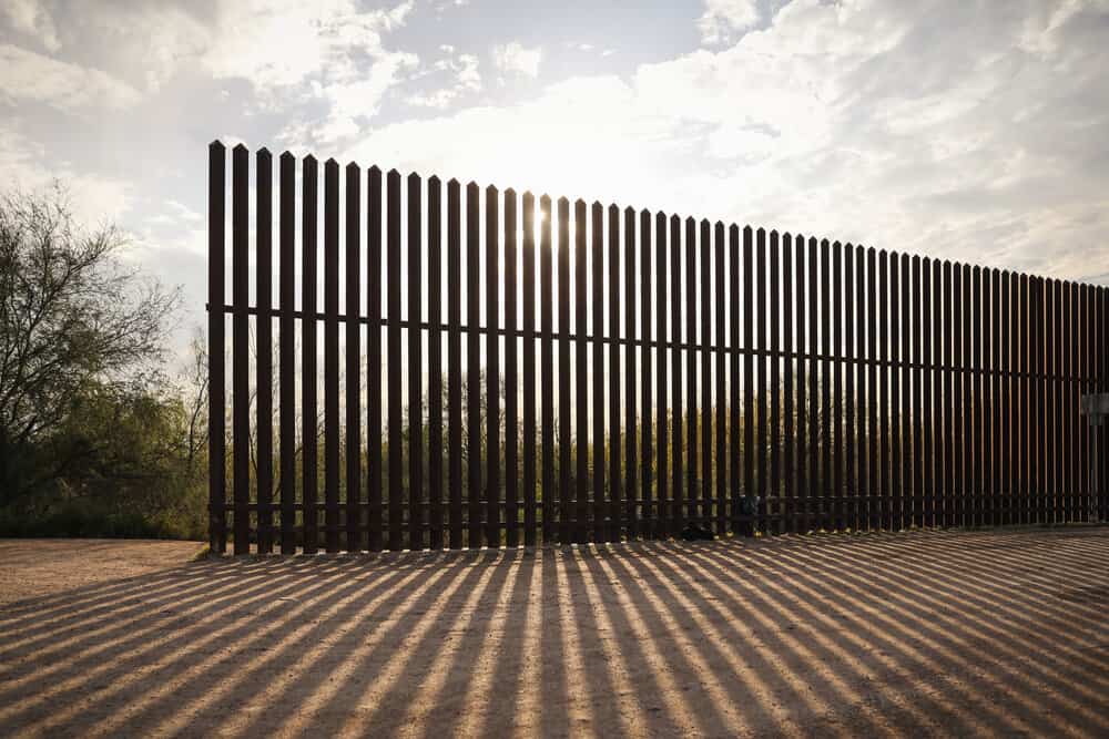
If Texas lion populations were possibly dependent on recruitment from Mexico, how would a border wall impact future dispersals? And if there’s not enough data to know how the population of the state’s largest predator even exists, what about all the other less-charismatic wildlife species, for which even less data exists? I decided to dive into the topic of how a contiguous physical border wall would affect wildlife, public lands, immigration, landowners and water access in Texas.
I’ve spent a large portion of my life along the border, and it’s a landscape that is near and dear to me. I managed a 10,000-acre hunting operation outside of Laredo for four seasons, guided aoudad hunts in the Sierra Vieja mountains above the Rio Grande in West Texas, and spent a lot of my spare time in Big Bend National Park and Big Bend Ranch State Park — the only massive chunk of public land in Texas at around three million acres combined. When people talk about building a border wall, it becomes personal when it could possibly be built through the landscapes that you love, and would have devastating impacts to the wildlife that you cherish.
Since the 2016 election, I’ve spent virtually all of my time documenting the Rio Grande and have interviewed wildlife biologists, Border Patrol agents, Democrat and Republican politicians, immigrants who’ve crossed illegally, ranchers, farmers, and everyday Joes on both sides of the border. On December 1, 2017, four friends and I embarked on a three-month, 1,200- mile journey down the Rio Grande from El Paso to the Gulf of Mexico using mountain bikes, my mustang horses, and canoes to see every inch of the border with our own eyes. I wrote a book and made a documentary about the experience, called The River and The Wall, which will be released by the time you’re reading this.
The theme of this Modern Huntsman issue is wildlife management, but before I dive into how our wildlife and public lands would be affected by a physical border wall, I want to make one thing clear: I believe wildlife management can only be accomplished within fairly stable societies that have enforceable laws intended to conserve wildlife and their habitat. The purpose of border security is to have a stable society and to enforce immigration and smuggling laws. I am a supporter of border security. I am a proud American. I am not for open borders, and I believe that a physical border wall has an effect in some areas and is absolutely asinine in others. Let’s dive in.
The US-Mexico border is 2,000 miles long, and 1,200 of those miles are along the deepest channel of the Rio Grande, the river that joins Texas and Mexico. As of today, there are approximately 650 miles of physical barrier along the border. Most of these barriers were built in 2006 and 2007 during the Bush administration under direction of the Secure Fence Act — an act that came out of a Department of Homeland Security study that looked for potential weaknesses against terrorists after the 9/11 attacks. In the vast majority of the urban areas along the border, there is already a 20-plus-foot-high wall. In New Mexico, Arizona and California, steel “Normandy” fences exist that block vehicle passage in rural areas but still allow wildlife and folks on foot to cross easily. From a strategy standpoint, a 20-plus-foot-high border fence or “wall” slows people down from 30 seconds to a few minutes. In an urban area, that amount of time can mean the difference between Border Patrol apprehending someone or them getting away. In a rural area, that amount of time doesn’t factor as much. That being said, there is an intimidation factor when you’re on the south side of the wall. But not nearly as intimidating as many of the treks migrants go through long before they get to the US-Mexico border. I’ve climbed the wall design in El Paso — it took me 27 seconds. While immigration experts will argue on whether the wall we currently have has slowed unauthorized immigration into the United States, pretty much everyone agrees that the current wall has pushed crossing migrants into more rural, hostile and gnarly terrain. This results in the Border Patrol having more time to catch and work groups, and also results in more migrant deaths due to the hostile nature of the desert southwest.
It is very important to understand that a “wall” or fence currently exists along most of the urban areas on the border. Future wall construction will go into increasingly more rural, wild and otherwise pristine landscapes. It will have a tremendous local impact on wildlife, and if it lasts for centuries like the Great Wall of China has, then it could have long-lasting effects on wildlife dispersal and genetic exchange. A sea-to-shining-sea wall would essentially block all north-to-south terrestrial movement on a continental scale, a feat historically only mountain ranges and oceans have been able to accomplish. Some high-ranking politicians have called for a contiguous wall, which indicates to me that it is not beyond the realm of possibility. Thus, I will break down segment by segment the border from El Paso to the Gulf of Mexico to describe what I believe the impacts are to wildlife and public land.
THE FORGOTTEN REACH
El Paso to Presidio
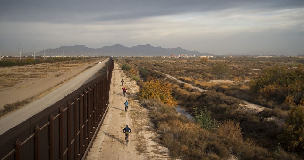
El Paso currently has about 70 miles of border wall separating the city and its suburbs from Juarez in Mexico. There are a few different designs of the wall in the El Paso area, from steel bollards to steel mesh to heavy-duty chain link. In my opinion, the wall near El Paso doesn’t do that much harm against wildlife movements because the area is so urbanized, farmed, and altered by the hands of man.
The wall ends downstream of El Paso when the terrain becomes mountainous and broken. For the next 100 or so miles, the area is known as the Forgotten Reach, because there’s little to no water in the Rio Grande due to upstream dams and diversions. The nearest 4WD road is often miles north of the border, and if a wall were to be constructed here, tens of thousands of acres would be stranded between the river and the wall due to the geographical constraints of suitable wall construction sites. I had the privilege of guiding aoudad hunts in the Sierra Vieja Mountain Range along the Rio Grande here. The landscape is a remarkably rugged, cactus-infused, extremely steep, aoudad-infested, broken mountain range. I don’t see how a man-made physical border wall could be more difficult to cross than that landscape.
The Forgotten Reach ends at the border town of Candelaria, and for the next 70 miles to Presidio, there’s a gravel road that turns to asphalt, which travels next to the river. A border wall could physically be constructed along this road, although currently it is not a priority area for construction
THE BIG BEND
Presidio to Lake Amistad
In Presidio, the Rio Conchos flows north out of Mexico, enters the Rio Grande, and brings the river back to life. It proceeds to flow through Texas’ largest state park, largest national park, and largest wildlife management area, as well as three area protegidas, or protected areas, in Mexico, and encompasses 191 miles of federally protected wild and scenic river. Compared to other Border Patrol sectors, this area gets a relatively low amount of illegal crossings and drug smuggling. Many locals in the Big Bend believe there’s no chance in hell the federal government would ever build a border wall there due to the extreme geographical challenges and comparatively low amount of illegal crossings. I’m less convinced, primarily because much of this area is public land. From a legal perspective, it’s easier for the federal government to build a wall on public land than to seize it through eminent domain from private landowners that’ll fight it every step of the way in court.
Downstream of Presidio, the Highway 170 “River Road” parallels the Rio Grande through Big Bend Ranch State Park, a 330,000-acre gem of a landscape that offers some of the best public land hunting opportunities in Texas. If a border wall were constructed here, it would likely be built along the river road, famous for being the most beautiful drive in the state of Texas. Highway 170 swings north, away from the river, when it hits Mesa De Anguilla in Big Bend National Park. This is where the truly massive canyons begin.
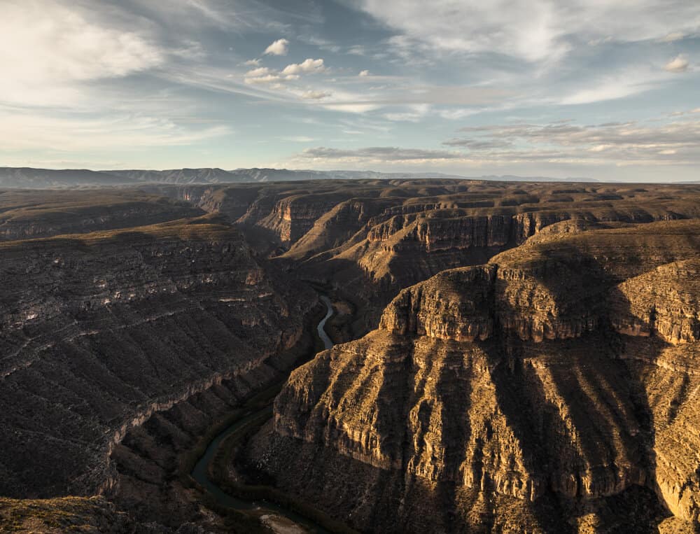
Santa Elena, Mariscal, Boquillas…to those of us who are lucky enough to have paddled these magnificent cathedral canyons, just hearing the names will create a yearning to float the river and stare up into landscape that seems to defy gravity and rivals the grandeur of the Grand Canyon. Every year, hundreds of thousands of tourists visit Big Bend National Park to paddle the river, float in the hot springs, or cross into Mexico for a taco and a beer. The importance of river access here cannot be overstated. Entire communities of outfitters and thousands of livelihoods depend on the tourism that the park and the Rio Grande provide. While a border wall is lunacy in an area with 1,000-foot-high canyons, there are gaps between the canyons where roads exist, and a border wall could possibly be constructed near the Rio Grande. It would have devastating effects on the area’s tourism, to wildlife, and to the psyche of many Texans who love Big Bend because it is our state’s only large public land playground.
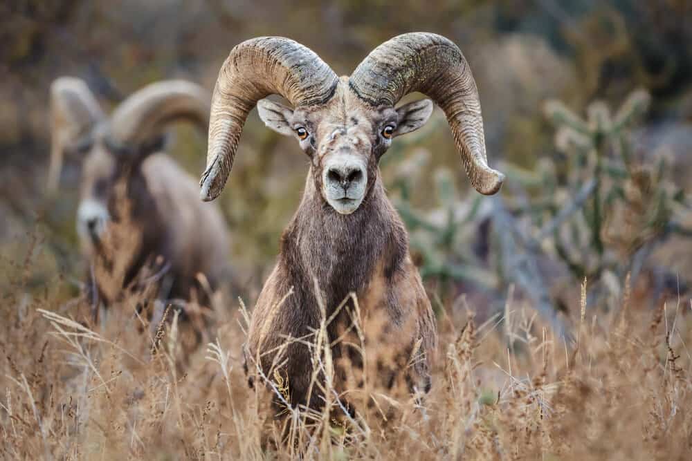
Let’s skip the wall talk and go into success stories for a moment, because the Big Bend region is full of them. After being eliminated from the state, desert bighorn sheep have been reintroduced and are thriving. Black bears are recolonizing Texas after their extirpation. Conservation NGOs, landowners and governments on both sides of the border place great value in landscape-scale conservation across the region, such value that an 80-year-old idea continues to resurface — the creation of a binational park between Mexico and the United States. An example of this exists in Waterton-Glacier International Peace Park on the US-Canada border. There are over one million acres of protected public lands in Texas’ Big Bend region and over two million acres of protected lands on the other side of the river in Mexico. If Mexico and the US could come together to form that international park, it would be 1.5 times the size of Yellowstone, equally magnificent, and much more biologically diverse. It would also bring neighborly symbolism in a time of tension between the two countries.
The Rio Grande connects these conserved lands between the US and Mexico and, for 191 miles beginning in Big Bend National Park, the world-renowned whitewater canoeing river is federally protected under the National Wild and Scenic Rivers system. Less than 2% of river miles in the country are protected as wild and scenic, and the Rio Grande is the only such in Texas. Under normal circumstances, a Wild and Scenic designation would prohibit large federal construction projects within half a mile of the river. However, under special provisions in the Secure Fence Act, the Department of Homeland Security can waive all environmental, cultural and local stakeholder safeguards to allow for border wall construction. That said, I find it highly unlikely that a physical border wall would ever be seriously considered in this stretch of the border due to the challenging terrain. In many locations, the wall would have to be built 10-plus miles from the river itself, and hundreds of thousands of acres would be ceded into the no-man’s land between the river and the wall. In the words of former CIA operative and Republican Representative Will Hurd from this district, “You have the Rio Grande, you have canyons, and the Chihuahuan Desert. You already have a barrier, it’s called mountains. In some places where there’s urban-to-urban contact, a fence makes sense because Border Patrol can measure their response time in seconds to minutes. But doing it in the desert and in Big Bend, that’s just crazy.”
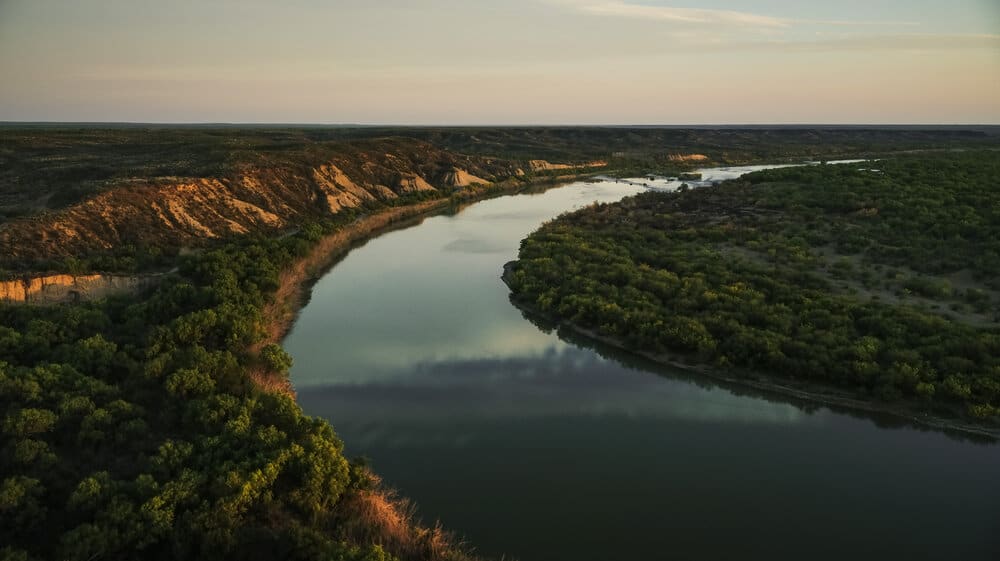
LAKE TO LAKE
Amistad to Falcon
Downstream of the Texas river canyon country, the dam at Lake Amistad (Spanish for friendship), impounds the Rio Grande, Pecos and Devils Rivers. The reservoir is famous for its clear water, renowned bass fishing, and drowned Native American artwork. I’ve never heard of anyone seriously proposing a border wall on the approximately 70 miles of the American side of Lake Amistad, but if one was to be built, it would have to be constructed over the Devils River, over the Pecos, and across an undulating countryside of limestone bluffs.
Below Lake Amistad, the Rio Grande is cold, clean, crystal clear, and bursting with smallmouth and largemouth bass. The river flow here is a combination of the Rio Grande, Pecos and Devils, and is in my opinion the most underrated and unknown part of the border for recreation. In the winter, every bend you make in the river is greeted with hundreds or thousands of waterfowl, especially bufflehead, wigeon and teal. Huge flocks of white pelicans fly up and down this stretch of the Rio Grande, and it starts to become somewhat tropical. Mixed in with the oaks cresting the limestone hills, native palms begin dotting the riverbank and Spanish daggers crest the horizon lines.
It’s a beautiful part of the border with sister communities on both sides of the river. In Del Rio and Eagle Pass, a border wall currently exists in the urban areas. In the rural areas, Border Patrol has camera towers on hilltops, blimps for surveillance, sensors, and roads that are dragged by tires frequently to pick up the footprints of people crossing illegally. In my opinion, the border wall here doesn’t have a great impact on wildlife and wildlife habitat because it is confined to urban areas. It does, however, restrict access to the Rio Grande and historic parks. In Eagle Pass, for example, there are soccer fields, barbecues, musical performances, municipal parks, and fishing on the Mexican bank, whereas on the American side, there is a wall that blocks access to the river that the community was founded on.
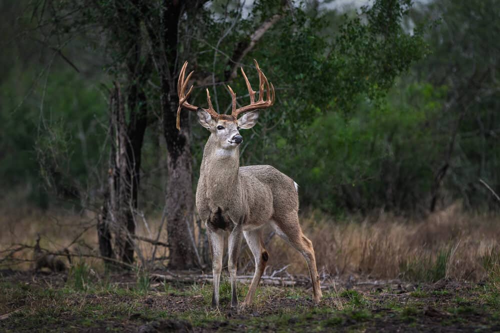
If a continuous wall were constructed along this section, it would be built through some of the largest ranches in Texas, which take tremendous pride in their wildlife and rangeland management. It’s not public land, but combined with the large ranches in Mexico on the other side of the river, it’s a wild-as-hell area with very low population density, huge white-tailed bucks, and only one “main” road, the Mines Road, which is closed off to the public. Many of the landowners here stretch back for generations, some are very wealthy, and they are not happy about the idea of the federal government seizing their land to build a wall that would block them from the river. Their voice isn’t often heard publicly, but it’s a powerful voice behind closed doors.
From the landowners that I’ve talked to along the border in this stretch, there is near-unanimous opposition to the border wall, because it would greatly alter their private land, their access to water, and their pride as Texans, and they believe that a physical wall would do little for actual border security. Further inland, I have met and talked to landowners who are in favor of the wall because they believe it will decrease the illegal traffic on their property and the possibility of theft or a dangerous encounter. I hear their frustrations. I worked on a ranch 40 miles east of Laredo near an old oil town called Mirando City for four hunting seasons. I know from experience that it can be scary working on a ranch on the border with hundreds of people crossing through it illegally each year. To have people who don’t look like you or speak your language bang on your door in the middle of the night asking to use the telephone to call the Border Patrol because their shoes are worn through, they haven’t drunk water in a day, and have given up. To see more migrants crossing illegally than deer on your trail cams. To have a Border Patrol truck blow up near the ranch house because the greenhorn agent drove over a bunch of brush that caught fire under the engine block.
So would a 22-foot-high wall keep migrants from crossing through the big ranch country between Amistad and Laredo? Maybe, but if someone is willing to walk 70-plus miles through the South Texas brush, they likely also have the resolve to climb a 23-foot ladder over a 22-foot wall. Border Patrol’s response time in areas like this can often be hours, whereas it takes only a minute or two to cross over the current fence design with the proper tools. A wall would help with detection, but that can also be accomplished with sensors, blimps, cameras, and technology that doesn’t have the negative ecological impacts and private landowner repercussions. If a wall was constructed in this stretch, I think it would likely either be built along the tick fence designed to keep cattle from Mexico out of the US, or along the Mines Road where the federal government wouldn’t have to fight powerful landowners in courts over eminent domain. If constructed on the Mines Road, hundreds of thousands of acres would be stranded between the river and the wall.
As you enter Laredo, the wild ranch country becomes urbanized on both sides of the Rio Grande. Laredo is one of the only major metropolitan areas that doesn’t have a continuous wall along its banks with Mexico. Instead, it has a large municipal park on the banks of the Rio Grande in its historic district. South of Laredo, the river flows through a patchwork of small communities, farms, and ranches for 40 or so miles before entering Lake Falcon. If a wall were constructed here, much of it would likely be built on the nearest available public road, some of that being Highway 83, which would certainly be devastating to communities such as San Ygnacio, which are directly on the river. According to a December 2018 Department of Homeland Security news release, this area is a top priority for future wall construction.
LOWER RIO GRANDE VALLEY
Falcon to the Gulf
For simplicity’s sake, I will consider the stretch of river from Lake Falcon to the Gulf of Mexico as the Lower Rio Grande Valley. The word “valley” isn’t accurate though, because it’s actually a delta. Historically, before the Rio Grande was dammed and diverted so much upstream, the river flooded this delta every year during heavy seasonal rains, created oxbow lakes, and breathed life into one of the most biologically diverse sub-tropical ecosystems in the United States. Today, less than 5% of this incredible Tamaulipan thornscrub habitat is left due to habitat loss, fragmentation, agriculture and urbanization.
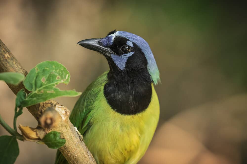
The ecological importance of this last 5% of remaining habitat cannot be overstated. The birding here is so incredible that the headquarters of the World Birding Center are located at Bentsen-Rio Grande Valley State Park, a short walk from the Rio Grande. For decades, private and public conservation entities have tried to create a wildlife corridor along the Rio Grande because it is such an important wintering habitat and stopover point for birds, bats and butterflies on a continental scale. The Nature Conservancy, Audubon Society, Texas Parks and Wildlife, National Butterfly Center, US Fish and Wildlife Service, and numerous private entities have invested tens of millions of dollars to conserve habitat along the border to create a string of pearls of protected lands along the Rio Grande for native wildlife. When you go there, it’s like stepping into the tropics, and the chorus of birds is overwhelming. Altamira orioles exalt their beautiful birdsong, chachalacas give raspy cries in the morning dawn, and green jays battle for territory under a canopy of dense trees. Birdwatchers flock there to see species that can be found nowhere else in the United States, thousands of school kids go there annually to learn about the natural world, and it is the sector with the highest amount of unauthorized border crossings along the entire US-Mexico border. There have been days in 2019 when the Border Patrol has apprehended over 1,000 unauthorized migrants in a single day. It is a nexus of biological diversity, asylum seekers, birdwatchers, immigrants in pursuit of a better life, Border Patrol agents fighting for the law to be upheld, and some of the most fertile soils in the world. It is ground zero for the wall.
In 2018, 1.6 billion dollars was allocated for border wall construction, much of it focused on the Lower Rio Grande Valley. The border wall will be built primarily on a system of levees outside of the floodplain. In some areas, these levees are near the Rio Grande, in other areas they are a mile or two from the Rio. Tens of thousands of acres of American soil will be between the river and the wall. Some stretches of the Lower Rio Grande Valley already have a border wall that was constructed in 2006, primarily in the urban areas, and the new construction will fill in the gaps, add gates, and be built through the more rural areas.
The Department of Homeland Security has already begun clearing land for the enforcement zone. Some of the most critical habitat in North America that is on your National Wildlife Refuge was bulldozed in March of this year. The wall is going up. As of March 21, 2019, some of the notable conserved areas such as the Santa Ana National Wildlife Refuge and Bentsen-Rio Grande State Park were spared from having a border wall and enforcement zone built through them. However, this could change if the President is successful in allocating funding through his National Emergency declaration for border wall funding.
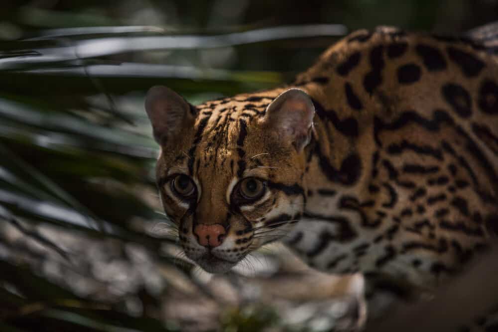
Construction of the border wall in the Lower Rio Grande Valley will certainly affect access to nature and public lands by the people who live there and to the tourism industry built around the incredible birdwatching. From a wildlife and habitat perspective, the enforcement zone will take out some of the last remaining habitat in this important region. The wall will also be the nail in the coffin for any naturally occurring genetic exchange or dispersals for the endangered ocelot in South Texas from their nearest population in Mexico. And when a flood occurs, such as after a hurricane, the wall will block terrestrial animals from escaping over the levy and could effectively function as a death trap. Conservation organizations and environmentalists have been opposing the wall here for years. But the wall is going up, and I personally would like to see the Federal government have a habitat mitigation program for everything they bulldoze. If they were able to add 100 acres of National Wildlife Refuge in this region (along with the funding necessary for habitat restoration) for every one acre that is destroyed for the border wall’s enforcement zone, it would be an olive branch to the people who care so deeply for this region and who are so offended at being walled away from their wildlife refuges and public land. To my knowledge, there has been no discussion of habitat mitigation.
As a Texan who loves to hunt, fish and recreate on the border, and who has traveled every mile of the Rio Grande from El Paso to the Gulf, it is infuriating to hear people refer to my beloved backyard as an expendable black line on a map when they haven’t ever set foot there.
The Rio Grande is a river before it is a border, and one that American soldiers died for in the 1848 Mexican-American War that extended US territory to the Rio Grande under the treaty of Guadalupe-Hidalgo. It is the river that flows through my state’s largest combined region of public land. It is my state’s only Wild and Scenic river and the continent’s fourth-longest river. It provides water for millions of people, serves as a life source for wildlife in the middle of a desert, irrigates farms, connects binational protected areas, and nourishes some of the most biologically diverse habitat in the continent. Do we really want to wall that off?
In the last decade, the majority of the unauthorized immigrant population has entered into the country legally via airplanes or ports of entry and overstayed their visas, rather than crossing the southern border. The vast majority of hard narcotics come through official ports of entry, not on somebody’s back. Many asylum seekers fleeing unprecedented violence in Central America look for Border Patrol at the river before they even reach the location of the proposed wall. Immigration courts are backlogged, detention facilities are beyond max capacity, and apprehended migrants are often released into the public after being given a court date that they never intend to show up to. Households, restaurants, farms and construction sites across the country fuel the demand for undocumented labor by paying in cash or by not using the e-verify system. And as long as American citizens are demanding $100 for an 8-ball of cocaine and $50 for an eighth of weed, the narcotraficantes will supply it. A physical border wall will not solve any of these root issues.
My fear is that the wall is a distraction that doesn’t address a broken immigration system, but will have far-reaching consequences to wildlife and wildlife habitat. I fear that Texas, which is less than 5% public land, will lose access to our best public lands, which are so unfortunately located in the crosshairs of this national debate. I love the idea that jaguars could once again be established in the United States from dispersals out of Mexico, that black bears continue to reclaim historic habitat in Texas from the source population south of the border, that bighorn sheep populations are connected by a river rather than divided by a wall, that a wildlife corridor connects endangered ocelots in South Texas to their counterparts in Mexico, and that lions in Mexico continue to supplement the Texas population.
As a nation, I believe it’s critical to address our broken immigration system and to recognize that border security is national security. But I deeply wish that a physical wall would be a last resort after all other options were attempted, rather than a symbolic band-aid on the broken leg of the immigration system. And it’s incredibly painful to think that my eyes might be some of the last to witness the grandeur of the landscapes sculpted by the Rio Grande before a border wall mars them forever.
This story was originally featured in Modern Huntsman, Volume Three: Wildlife Management